
Honda Fit: Coordinate
 DEST button
►DEST Menu 2►Coordinate
Specify a location using latitude and longitude map coordinates.
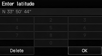
1. Enter the latitude. Select OK.
2. Enter the longitude. Select OK.
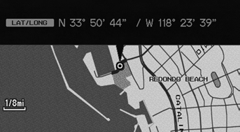
3. Scroll the map to position the cursor over your desired destination, adjusting the map scale as necessary. Press the ENTER button.
► If the address is not the desired location, scroll to another location and try again.
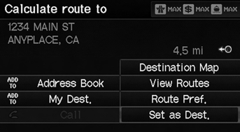
4. Press the ENTER button again to display the route calculation menu.
5. Select Set as Dest.
Latitude and longitude must be entered up to the seconds’ value.
A yellow box (shown at scales above 1/4 mile) denotes the area that can be viewed when you press the ENTER button on the current map.
Information icons are displayed at scales from 1 mile to 1/4 mile. Place/landmark icons are displayed at 1/8 mile or less. Roads are displayed at 1/4 mile or less.
If you select multiple icons within the cursor radius, you are prompted to select one of the items from a list.
See also:
Online Reference Owner's Manual
This owner’s manual should be considered a permanent part of the
vehicle and should remain with the vehicle when it is sold.
This owner’s manual covers all models of your vehicle. You may find ...
Clutch Clearance Inspection (A/T)
Special Tools Required
Clutch Compressor Attachment 07ZAE-PRP0100
Inspect the clutch piston, the discs, the plates, and the end-plate for
wear and damage, and inspect the clutch wav ...
Spelling Assistance
The voice control system can also
recognize phonetic alphabet input for
numbers, letters, accented letters,
punctuation marks, and symbols.
NOTE:
When selecting letters using the voice
control s ...
Categories
